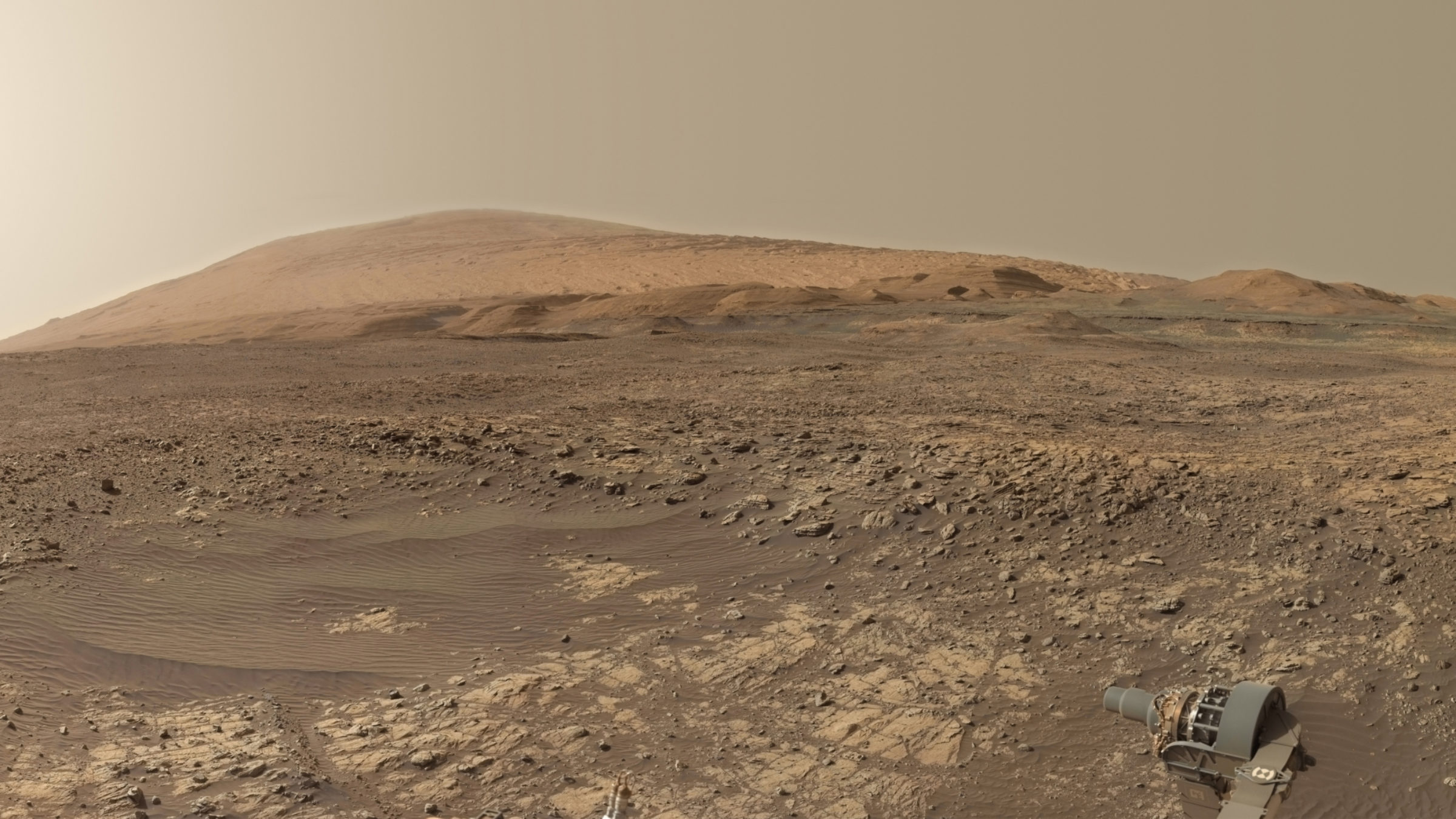
Curiosity, exploring Mars' surface
How did Mars transform into an inhospitable desert?
Highlights
- NASA’s Curiosity rover landed on Mars in 2012 to search for evidence that the planet could once have supported Earth-like life. It found that its landing site, Gale Crater, once had a calm lake that could have supported life.
- Curiosity is now studying how Mars' environment transformed into an inhospitable desert. Its ongoing weather and radiation observations are helping prepare for human exploration of Mars.
Why do we need Curiosity?
Curiosity’s original mission was to figure out whether conditions in Mars’ past were once amenable to life as we know it. The rover’s predecessors, Spirit and Opportunity, found that water once existed on Mars’ surface, but they were leaner robot field geologists. Curiosity was a full-blown mobile science laboratory that would use its instruments to determine whether samples it collected formed in an environment that had the right chemical mixture for life.
Millions of people watched Curiosity’s riveting landing on Aug. 5, 2012, including thousands spontaneously gathered in New York City’s Times Square, and 3,000 Planetary Society members watching in Pasadena, California. The new and daring landing process, dubbed the “seven minutes of terror” after the amount of time it took Curiosity to travel from space to Mars’ surface, involved a supersonic parachute and rocket-powered “skycrane” that lowered the rover to the ground via nylon cables.

What are Curiosity's mission objectives?
Within a year, Curiosity achieved its primary goal of verifying that Gale Crater, where it landed, was an ancient lakebed that had water and chemical elements that once could have supported life.
Now in extended mission operations, Curiosity is continuing to look for signs of life in Gale Crater. In January 2022, scientists reported that rock samples found by Curiosity revealed interesting carbon signatures. On Earth, these can be associated with signs of life. However, much more research is needed to determine what these organics actually were and where they might have come from.
By continuing to gather weather data as it drives up Mount Sharp, Curiosity is helping Mars meteorologists understand how the planet’s atmosphere and dust levels change with increasing elevation, which will help them make better weather predictions in the future.

How Curiosity explores Mars
Curiosity is a mobile science laboratory. Using images from navigation cameras placed strategically around the rover, as well as images from orbital satellites such as NASA’s Mars Reconnaissance Orbiter—scientists and engineers work together to drive Curiosity across the floor of Gale Crater and up Mount Sharp, stopping for weeks to months at a time to collect data and drill at scientifically interesting spots.
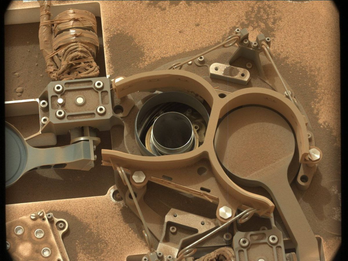
The rover’s robotic arm collects soil and rock samples with a drill and scoop, and then drops them into its belly for analysis. SAM, short for Sample Analysis at Mars, figures out what carbon-containing compounds and other materials necessary for life are preserved in the rocks. CheMin, the Chemical and Mineralogy instrument, analyzes the types of minerals present in the rocks to tell how favorable to life the environment was when the rocks were first laid down as sediments.
In addition to the cameras that help rover operators plan drives, Curiosity is equipped with a variety of cameras to help scientists study rocks for clues, including whether they formed in still or running water. A camera on the robotic arm, MAHLI, is similar to a magnifying glass a geologist would carry into the field, while a pair of cameras on the rover’s mast, collectively known as Mastcam, capture multi-color images that can be stitched into sweeping panoramas.

How does Curiosity take selfies?
Curiosity takes selfies by stretching out its robotic arm and turning the MAHLI camera back on itself. Because the camera’s field of view is so narrow, multiple images must be taken and stitched together back on Earth. The robotic arm must be cropped out in the process, which can cause confusion for people viewing the stunning result.
Other Curiosity science instruments include ChemCam, which zaps rocks with a laser
and records the resulting light through a telescope to determine the
chemical and mineral composition of the rocks, as well as weather and
radiation monitoring instruments. See the full list of instruments here.
How you can support the Curiosity mission
You can sign up for our monthly Space Advocate Newsletter to stay engaged in NASA’s budget process and get notified when we have ways for you to take action.
Support missions like Curiosity
Whether it's advocating, teaching, inspiring, or learning, you can do something for space, right now. Let's get to work.


 Explore Worlds
 Find Life
 Defend Earth


